Citizen Monitoring and Training
- Details
- Written by Mr. Brian Oram, PG
Help to Support / Promote this Portal
Water Quality and Pathogenic Disease Laboratories
The Drinking Water Testing Laboratory and Education/ Resource Center
Citizen Monitoring and Training Programs
Started in 1982 (Over 20 yrs of Experience)
The certified laboratory has worked on projects related to acid mine drainage ( AMD ), mine drainage, lake and stream monitoring programs, wetland creation and monitoring, filtration plant performance evaluations, testing new point of use water treatment devices and systems, hydrogeological evaluations, geological investigations, water well drilling and construction, drinking water testing and land reclamation. The Center has also been involved with Citizen Monitoring and other Environmental Training Programs for groups within the United States (Pennsylvania, New York, New Jersey), Europe, India, and even the former Soviet Union. The staff of the Center is available for education conferences and workshops.
Under the Citizen Monitoring Program we can provide assistance in training (field, laboratory, and workshops), developing QC/QA Plans (QAPP), selecting monitoring equipment, establishing testing protocols, developing a database, conducting datagap analysis, GIS/GPS assistance, laboratory support, online resources/information, and other technical assistance in data review. In addition to these services, we can conduct workshops on subjects related to water quality, groundwater resources, non-point source pollution, water well construction, drinking water quality, lake and watershed management, and on-lot wastewater disposal. New online Water Quality Index Calculator for Surface Water.
Program to support Watershed Organizations In Pennsylvania - The C-SAW Program.
Program related to the Marcellus Shale - Getting the Waters Tested - The Marcellus Shale Factor.
Please visit the Homeowner - Private Well Owner Outreach Program (Informational Water Testing).
Pennsylvania Groundwater System
- Details
- Written by Mr. Brian Oram, PG

A Brief Explanation on Groundwater Flow Systems and
Groundwater Hydrogeology in Pennsylvania

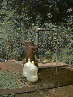
A flowing artesian well- Free Water NO Pumping Needed
- Hydrologic Cycle
- Occurrence of Groundwater
- How Groundwater Moves
- Factors Affecting Groundwater Declines
- Definitions
Potable water is most valuable and under appreciated resource of our planet. Why? Because in many locations, the "aquifer" is hundreds of feet below ground and extends over a vast area that includes multiple municipal and state boundaries. Over 70 percent of the earth's surface is covered with water, but < 0.5 % of this water is usable freshwater resource. All the remainder of the water is salt water. The water on this planet moves through a cycle that is the ultimate solar power system and the cycle is in dynamic equilibrium. Water is constantly changing position, phase, and form, see Figure 1.

Figure 1. Water Cycle
(Source: US Climate Change Science Program / US Global Change Research Program,
Suite 250, 1717 Pennsylvania Ave, NW, Washington, DC 20006. Tel: +1 202 223 6262.
Fax: +1 202 223 3065. Email: information@usgcrp.gov. Web: www.usgcrp.gov. Webmaster: WebMaster@usgcrp.gov
This dynamic cycle causes the water to be in motion which aids in the remediation/purification process, influences the movement of critical ions and elements through the ecosystem, and supports critical nutrient and energy cycles. One of the most misunderstood and poorly characterized components of this cycle is known as groundwater. This is misunderstanding and lack of awareness is because groundwater can not be readily or easily seen of visualized and there area multiple biochemical process that cause the water to transform. For information on the water cycle, please view this Power Point Image
Table 1 is a breakdown of the number of the number and percent of homes that are serviced by
a private water system. In most cases the private water system is a groundwater well.
Table. 1. PA Census Data.
|
# of homes served by private water systems
|
Avg. Change in homes served by private water systems per year
|
% of all homes served by public water
|
% of all homes served by private water system
|
|||
|
County
|
1980
|
1990
|
2000
|
|||
|
Bradford
|
13,443
|
16,865
|
20,287
|
+342
|
37
|
63
|
|
Carbon
|
6,594
|
12,235
|
17,876
|
+564
|
55
|
45
|
|
Lackawanna
|
9,952
|
12,745
|
15,538
|
+279
|
86
|
14
|
|
Luzerne
|
19,994
|
24,662
|
29,330
|
+467
|
82
|
18
|
|
Monroe
|
21,129
|
37,246
|
53,363
|
+1612
|
32
|
68
|
|
Pike
|
9,441
|
16,875
|
24,309
|
+743
|
45
|
55
|
|
Sullivan
|
2,147
|
4,727
|
7,307
|
+258
|
13
|
87
|
|
Susquehanna
|
9,423
|
15,212
|
21,001
|
+579
|
25
|
75
|
|
Tioga
|
9,126
|
11,888
|
14,650
|
+276
|
35
|
65
|
|
Wayne
|
9,913
|
19,097
|
28,281
|
+918
|
33
|
67
|
|
Wyoming
|
7,236
|
8,657
|
10,078
|
+142
|
27
|
73
|
|
Region
|
118,398
|
180,209
|
242,020
|
+562
|
43
|
57
|
Source: PA Census Data.
The primary sources of usable water is Pennsylvania include rainwater , stream inflow from other states, surface water (stored in lakes, streams, and ponds), and groundwater. In 1966, it was estimated that Pennsylvanians use approximately 6.6 billion gallons of water per day and there is approximately 80 trillion gallons of groundwater and only 2.5 trillion gallons of surface water (DCNR, Educational Series 3: " The Geology of Pennsylvania's Groudwater"). Below the freshwater aquifer, the bedrock contains salt or brine water. This brine water is likely water that was trapped in the formation or material during deposition.
Because of the rural nature of Pennsylvania, groundwater provides approximately 85 percent of the water used for human consumption, but because it is difficult to see how water moves through the soil, unconsolidated material (sand and gravel) and bedrock, it has mystified individuals. For some homeowners, they believe that the groundwater comes from a vast underground lake or from underground streams that come from Canada, Virginia, Vermont, or even Maine. Even through there is a large database of information on groundwater in Pennsylvania, it still is difficult to really document the total available resource and actual movement and quantity without implementing a very elaborate system of monitoring wells, observation points, and background water quality data.
Hydrologic Cycle
For Pennsylvania, the annual precipitation ranges from 30 to 60 inches per year with a mean rainfall of approximately 41 inches. Approximately 55 to 60 percent of the precipitation occurs during the warmer months. Of this approximately, 20 inches or more is returned to the atmosphere via evapotranspiration (ET) or evaporation, 12 to 15 inches infiltrates into the groundwater system, and direct runoff accounts for approximately 6 to 12 inches of water. Groundwater storage in Pennsylvania is equivalent to approximately 100 inches of water, but a more conservative estimate is 47 trillion gallons (60 inches), of which, 9 to 12 trillion is naturally discharged to springs, seeps, streams, and lakes, see Figure 2. Therefore, groundwater is not only used for drinking water, but the discharge of groundwawter to the surface and near-surface provides the necessary baseflow to support the aquatic habitats in Pennsylvania.

Figure 2. Average Water Budget for Pennsylvania. (Source: PSU, 2007).
The hydrologic cycle describes the constant movement of water above, on, and below the earth's surface. As part of this cycle, water is transformed between liquid, solid and gases states. Condensation, evaporation and freezing of water occur in the cycle in response to the earth's climatic conditions. Figure 2 is a representation of the general hydrologic cycle that directly affect Pennsylvania.
The hydrologic cycle can begin with water evaporation from the earth's soil, plant and water surfaces to form water vapor. The energy required to evaporate water is supplied by the sun- Therefore the System is Solar Powered, see Figure 3. Most of the evaporation occurs near the equator in the open ocean. It is estimated that 39 inches of water annually evaporate from each acre of ocean. Water vapor is drawn into the atmosphere by temperature gradients and can be transported over hundreds of miles by large air masses. When water vapor cools, it condenses to form clouds. As water condenses within clouds, water droplets increase in size until they fall to the earth's surface as precipitation such as rainfall, hail, sleet, or snow.
Approximately 50 to 90 percent of the water that falls to the earth's surface enters the soil. This water can become groundwater, but most of it evaporates from the soil surface or is used by vegetation via evapotranspriation (ET) or infiltrations into the surface and flows to streams and springs as interflow. Water that passes through the root zone may continue to move downward to reach the groundwater. In soils with fragipans, claypans or other low permeable strata of a limited extent, this water may create a seasonal high or perched water table. The distance water has to travel to reach groundwater can range from a few feet to hundreds of feet. Water movement toward groundwater may take hours or years, depending on the depth to the aquifer and the characteristics of the unsaturated zone.

Figure 3. The Solar Powered Water Cycle - Cross-Section of Water Cycle System.
(Source: League of Women Voters- "Groundwater: A Primer for Pennsylvanians")

Figure 4. The Water Cycle and Community. (Source: League of Women Voters- "Groundwater: A Primer for Pennsylvanians")
Occurrence of Groundwater
Groundwater is stored in the voids, spaces and cracks between particles of soil, sand, gravel, rock or other materials. These cracks or space can include fractures, faults, bedding planes, solution channels (limestone formations), dissolution channels associated with more easily weathered material or other structural features such as bed planes or deformation in the bedrock due to folding. These materials form what is sometimes called the groundwater aquifer or reservoir. In most areas of the world, and specifically in Pennsylvania, water does not flow in and is not stored in large underground lakes or rivers. The only exception to this might be the dissolution channels and caverns associated with limestone formations, abandon mining sites, and mine shafts associated with underground mining operations.
The types of aquifers in Pennsylvania include: unconsolidated (sand and gravel deposits), sandstone, carbonate, and crystalline rock, see Figure 5. From a review of Figure 5, the major water bearing aquifers in Pennsylvania are associated with sandstone and shale or sedimentary rock units.

Figure 5. Types and Distribution of Aquifers in Pennsylvania. (Source: League of Women Voters- "Groundwater: A Primer for Pennsylvanians")
Near surface the material can be divided into the unsaturated or saturated zone. Recently, the unsaturated zone has been termed to vadose zone to make it clear that the material may at times be saturated. Water in the vadose zone can move via saturated and unsaturated conditions. Under saturated conditions, the gravitational potential or gravity is the driving force, but under unsaturated conditions osmotic and matric forces are major influence, see Figure 6. Figure 7 depicts the potential relationship between a recharge area and a discharge zone and the influence of an aquitard. Figure 7 shows that at some point in the landscape the aquifer is exposed near the surface. Recharge enters that aquifer, but in some cases an aquitard, i.e., a formation with a permeability that is at least 10 times, lower than the aquifer acts as a confining layer. This confining layer causes the water to be directed downslope and causes pressure to "build-up" in the confined aquifer. If there is a fracture or weakness in the confining layer, the water will move up from the deeper groundwater zone and discharge to the surface or shallow groundwater aquifer (look at the arrows in Figure 7). Figure 7 also depicts the difference between an unconfined and a confined aquifer.

Figure 6. The Water Table - Which way is water flowing? (Look at the Arrows).
Which way is the Water Flowing in the Saturated Zone ? In This Image - there is no horizontal water flow only vertical.
(Source: League of Women Voters- "Groundwater: A Primer for Pennsylvanians")

Figure 7. Confined and Unconfined Aquifers and Direction of Flow. Why way is water moving ?
(Down, Up, to the Left) - Water Under Saturated Conditions -
Always Moves from an Area of High Head to Areas of Low Head.
(Source: League of Women Voters- "Groundwater: A Primer for Pennsylvanians")
Figure 8 demonstrates the creation of a perched water table and the relationship between a stream/wetland and the groundwater system. In this figure, the flow from the stream is supported by a discharge from a perched water table (a the surface this could appear as a spring or seepage) and a discharge from the unconfined aquifer. Because the confining layer was competent, the confined aquifer does not discharge to this stream. If the confining layer was weak just below the stream location, it would be possible for water to "leak" up out of the confined aquifer to discharge at this stream. In this figure make sure to note the location of the watershed divides. Figure 9 depicts the relationship of the various water flow paths in a vertical section of the groundwater aquifer. It is important to note that the age of the groundwater discharging from the freshwater aquifer in some of our major water ways could be counted in centuries to millennia and that below the freshwater zone the groundwater formation can contain salt or brine water.

Figure 8. Groundwater and Its Relationship with Surface Water.
(Source: League of Women Voters- "Groundwater: A Primer for Pennsylvanians")

Figure 9. How Old is this Water I am Drinking? There is Salt Water in Pennsylvania.
(DCNR, Education Series 3 - The Geology of Pennsylvania's Groundwater).
To understand how we can remove groundwater using wells, we must understand how groundwater moves. Some people attempt to associate the flow of water on the earth's surface with groundwater movement. Surface water flows in rivers or streams at velocities of 2-8 miles per hour. Pennsylvania's groundwater moves through the spaces between particles of a saturated material at rates between 0.1 foot per day to 3 feet per day. That translates into movement of 35 to 1,100 feet per year.
Groundwater moves only if sufficient pressure, or head, is available to force water through the spaces between porous aquifer materials. Rate of movement is determined by the hydraulic gradient, permeability, and porosity of the material. The hydraulic gradient, or slope of the water surface between two points in an aquifer, and the aquifer material determines how rapidly water moves from one location to another.
Groundwater moves from high water surface elevations (high pressure or head) to low water surface elevations (low pressure or head). In general, the water flows more rapidly where large differences exist in water surface elevations (steep hydraulic gradients), but this is not always the case. A large variation in the hydraulic gradient could also mean an lower permeability formation.. Groundwater may move toward or away from streams or lakes, depending on the hydraulic gradient. As groundwater moves it may be removed by a pumping well, or it may be discharged to the earth's surface as a spring, a lake or stream. Groundwater supplies are recharged by precipitation or from rivers and lakes. Groundwater removed by wells or discharged by springs may have been stored for thousands of years, or may have entered the aquifer quite recently.
Factors Affecting Groundwater Declines
Under natural conditions, a balance exists between the volume of water entering an aquifer and the volume of water being discharged from an aquifer. Under natural conditions, the water is discharged from the aquifer through evapotranspiration, seepages, streamflow, and direct discharge to bays/oceans. With the development of water wells, the natural balance between recharge rates and discharge rates is disrupted and an artificial groundwater discharge zone is created when water is extracted from the ground. As long as the artificial discharge is balanced by enhanced recharge at the surface, such as the use of on-site well and septic systems, facilitated or induced stormwater recharge, or large volume treated effluent recharge systems, the water cycle stays near balanced. If these additional man-made or influence recharge systems are established, the result of over-pumping or over-withdrawing water from the aquifer could cause low baseflows in streams, warmer streams, less aquatic habitat, high storm or peak flows in streams because of more runoff, and potential failure of the groundwater system because of settling of an unconsolidated formation or induced contamination because of over-pumping.

Figure 10. Groundwater Elevation, Baseflow, and Recharge.
(DCNR, Education Series 3 - The Geology of Pennsylvania's Groundwater).
Just like streams, the water level in the groundwater aquifer changes throughout the year and from year to year. The groundwater elevation and amount of baseflow is directly influence by the amount of precipitation and recharge. From Figure 10, it is apparent that as the amount of recharge increases so does the baseflow for the stream, but as the groundwater recharge rate decreases so does the baseflow for the stream.
Water Quality in Pennsylvania and Other States
See also the Glossary of Terms
The Water Library Household Well Water
- Details
- Written by Mr. Brian Oram, PG

Drinking Water and Environmental Library
Information on Drinking Water for Household Private Wells
Downloadable - pdf, wpd, html pages and other files
Private Water Wells, Rural Water Wells, Springs
This is a reference library that has been compiled on a number of topics ranging from water quality, household drinking water, water treatment, evapotranspiration, groundwater, lake management, mold, private well water quality, septic systems, radon, and wellhead protection.
Unlike public drinking water systems serving many people, private water wells owners do not have experts regularly checking the water’s source and its quality before it is sent to the tap. These households must take special precautions to ensure the protection and maintenance of their drinking water supplies. Private well owners need to get and document information on the nature and quality of their drinking water and get the drinking water tested.
New Booklet - "Water Quality - Your Private Well - What Do the Results Mean?"

The Keystone Clean Water Team
Helping Private Well Owners (Fact Based Resource)
Homeowners Get Your Water Tested as
Part of Our Private Well Owner Drinking Water Testing Program
Online Training Courses
LEED- AP / Green Associate Training/
Professional Development Hours Courses
Wetland Education and Training
Inland Restoration; Wetland Delineation (Basics)
National Drillers Training Courses
Drilling Safety, Monitoring Well Design/ Install,
and Groundwater Basics
Water Well Design (other training provider)

Join Our Newsletter
Sign Up to Receive
Our FREE Newsletter for
the Latest News & Information

New Booklet

Order Your Copy of the PA Water Quality Guide
Covers issues related to water conservation, the sources of pollution, ensuring that private water supply systems produce safe drinking water and protecting the long-term quality of our water sources.